


This route includes two greenways: The Dénia-El Verger greenway and the Safor greenway (Oliva-Gandia) as well as the connection between them through paths and roads.
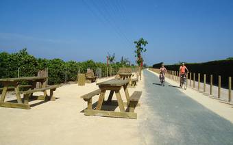
The Greenway of Dénia – La Safor recovers the route of the historic railroad that linked Dénia with Carcaixent, in operation from the late nineteenth century until 1974. Today, this old railway corridor has been transformed into a natural route designed for walkers and cyclists, linking landscape, history and sustainable tourism along about40 kilometers between the Marina Alta and the region of La Safor.
The itinerary starts inDénia, from the Greenway Dénia-El Verger advances northwards crossing the Natural Park of the Marjal Pego-Oliva, the Font Salada and Oliva, until reaching Gandia. The route runs through orange groves, irrigation ditches, wetlands and small towns, with open views and completely flat stretches, making it an accessible route for all ages.


Route Data